
Costa Rica Road Trip Part 1 — The Nicoya Peninsula, 9-13/11 2025
9 November — Sunday
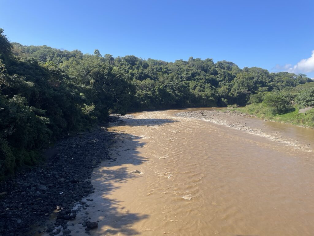
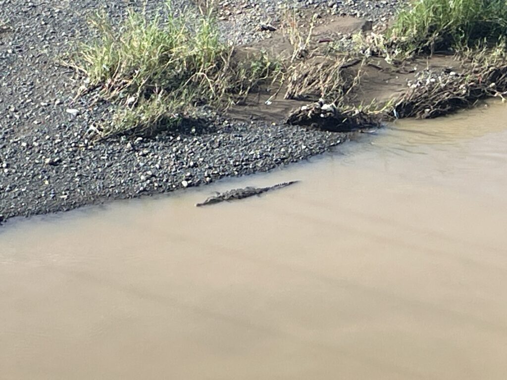
We leave Jaco early in the morning driving towards Paquera located south on the Nicoya Peninsula. The Nicoya Peninsula is known for being a blue zone (a place rich in centenarians). On the way we stop at Puente Rio Grande de Tarcoles to look for crocodiles. There were none, but we saw crocodiles under another bridge we passed instead.
The original plan was to take the boat from Puntarenas to Paquera. However, the time tables were not updated on the website. The boat we thought departed at 10:00, actually left at 09:30. Instead of waiting several hours, we decided to drive.
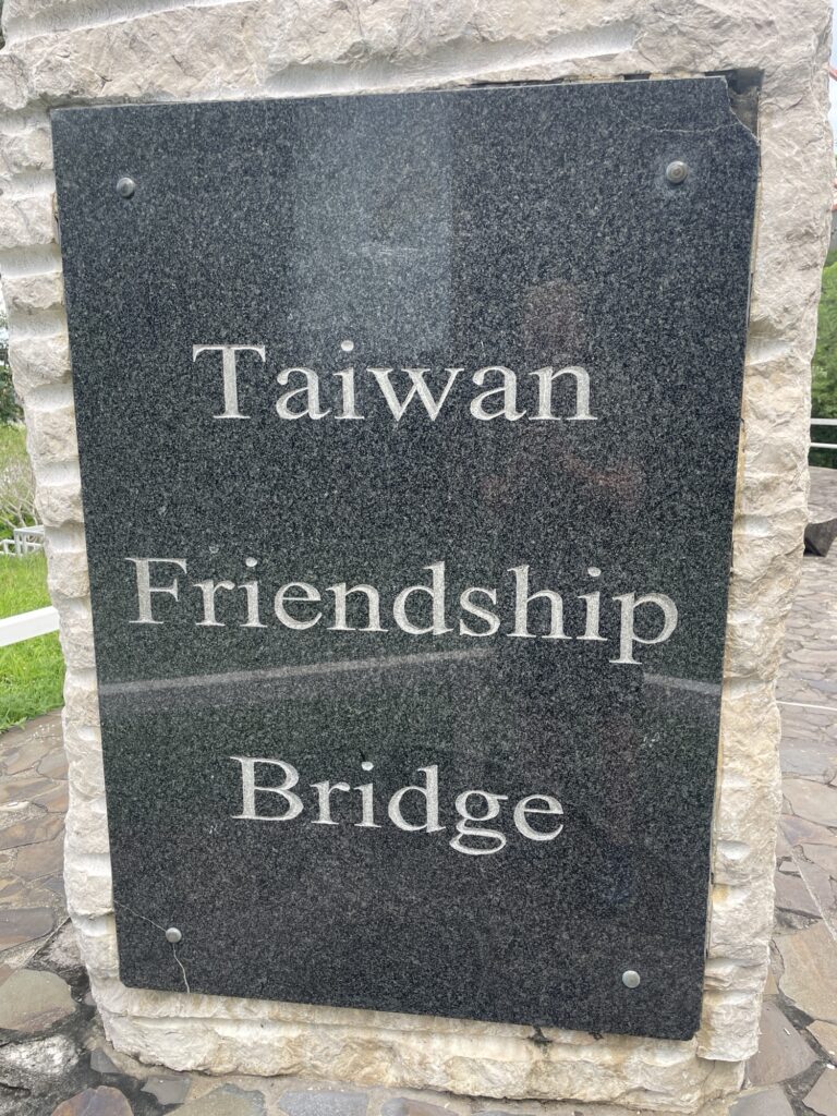
The brigade over the river Tempisque was somewhat surprisingly called “Taiwan Friendship Bridge”. Will Costa Rica aid Taiwan in an imminent PLA invasion? I later learned that Costa Rica has no standing army since 1949. I guess big daddy got them covered.
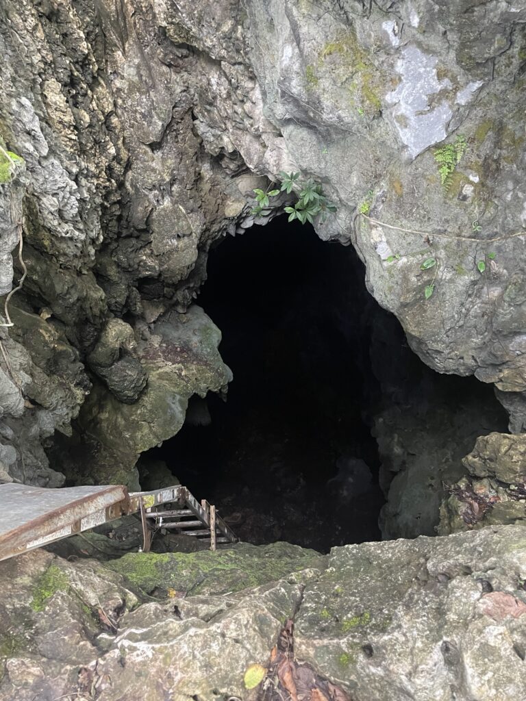
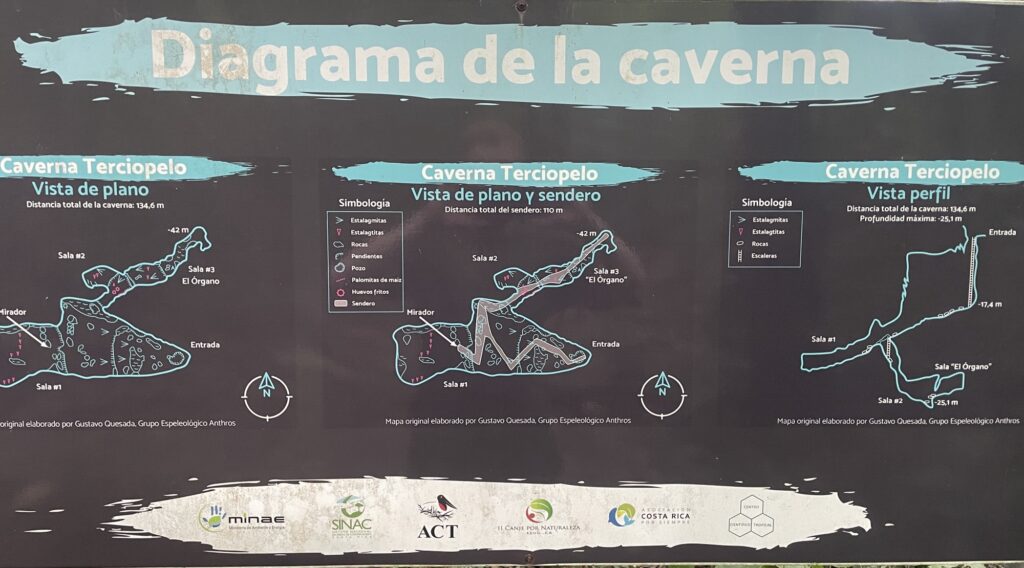
We make a quick detour to the Parque Nacional Barra Honda, mostly known for its impressive cave system, which of course you are not allowed to visit without an expensive (40 USD) guide.
Same as for most national parks in Costa Rica, the online information is very contradictory. Online it says that you are allowed to camp at a designated campground. But according to the park rangers that is not the case, despite there being a campground symbol on the map at the entrance. “We do not know why that symbol is there” — park rangers. As said, much contradictory information.
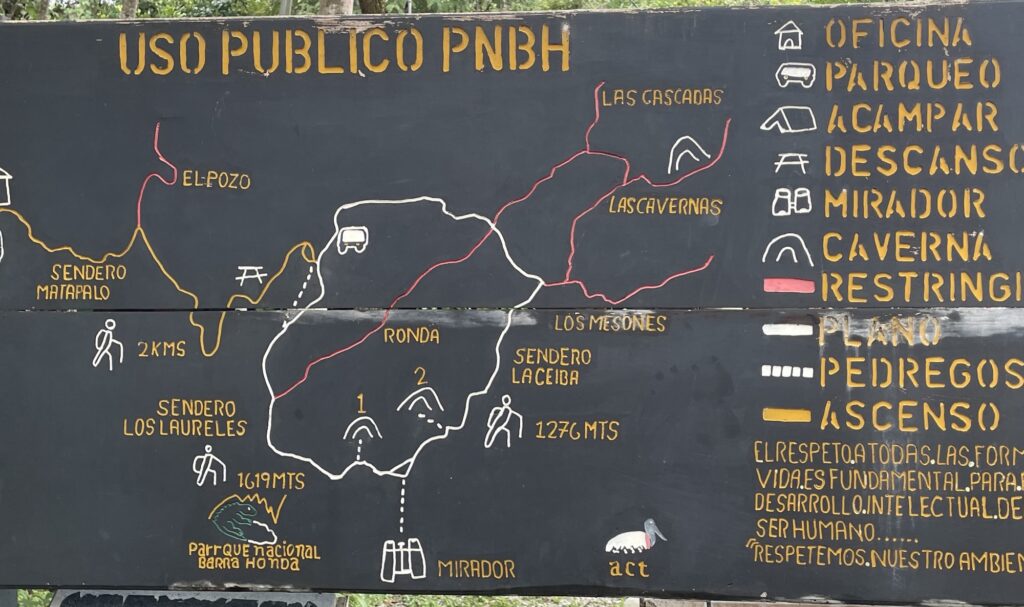
We pay the 13.5 USD/person fee and start hiking the one loop trail the park has to offer. It is mostly a very easy trail, in fact it is a dirt road made for Jeeps or other terrain vehicles.
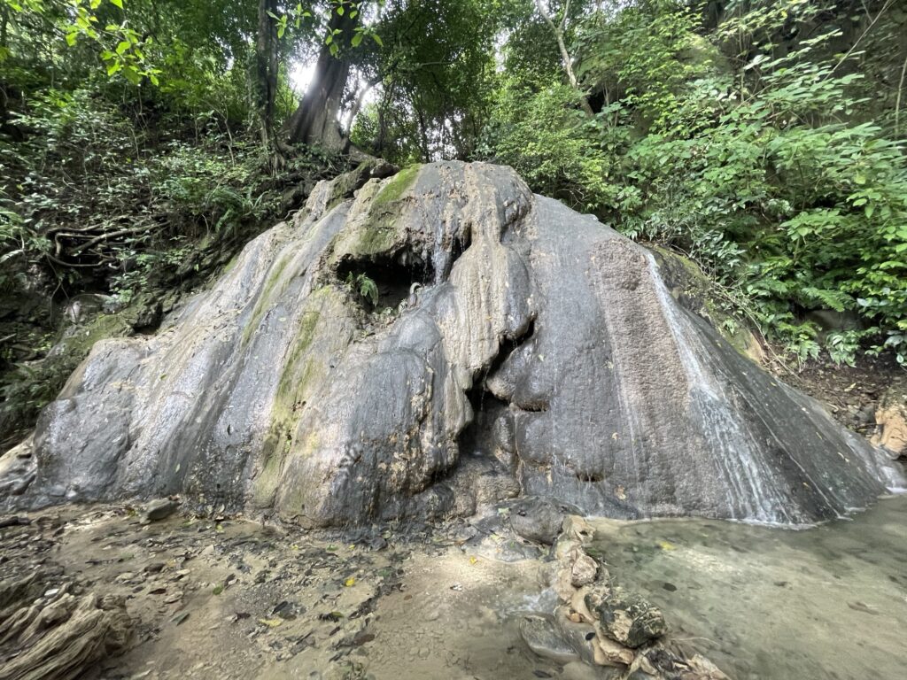
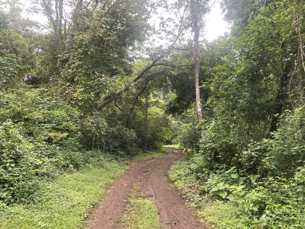
It was a nice walk, but nothing too exciting. After the hike we continue driving to Paquera where we tuck in for the night.
10 November — Monday
Today we are driving to Montezuma to visit waterfalls and bask in the sun on the never ending beaches.
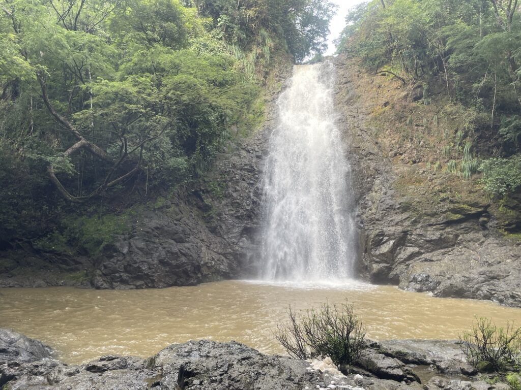
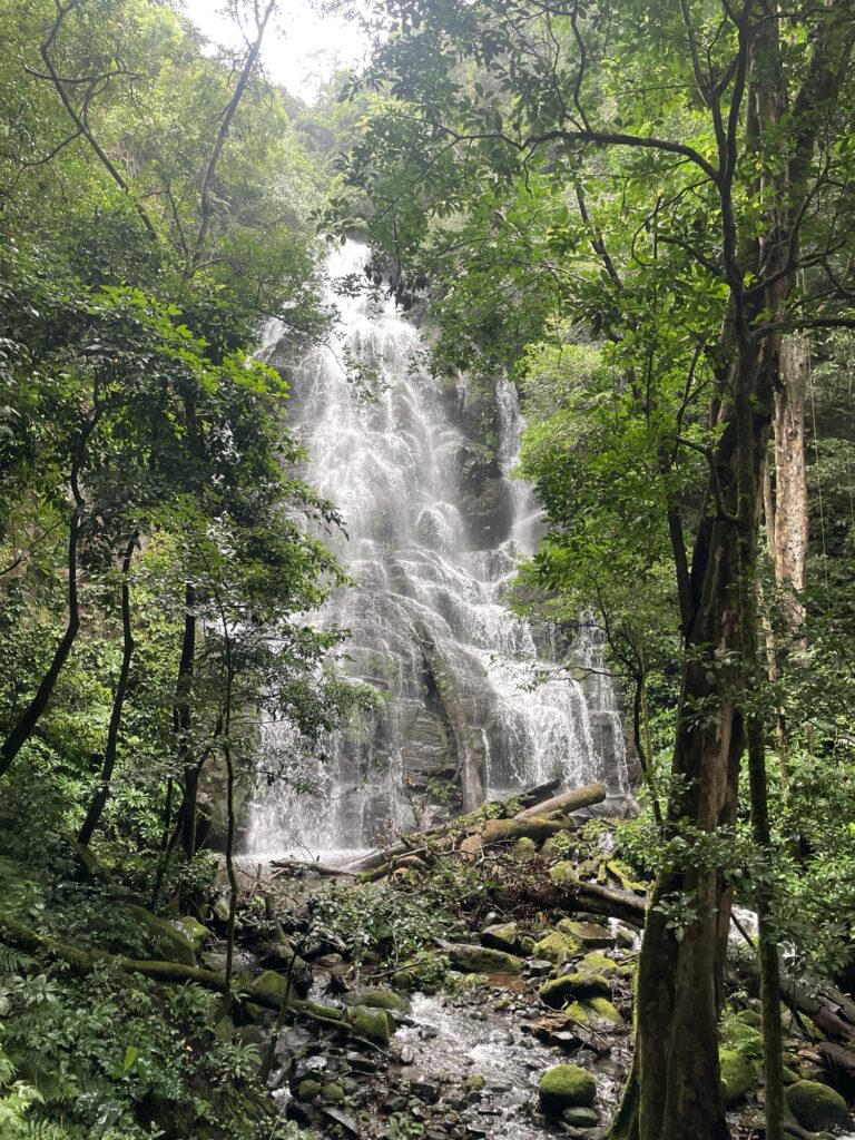
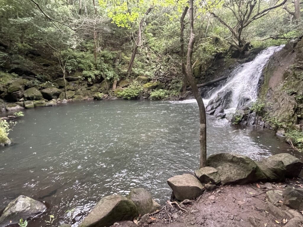
The hike to Montezuma waterfall is only 15 minutes one-way. But it is wet, muddy, and extremely slippery. Much of the “trail” runs through the river. At the base of the waterfall there is a big pool to bath in, and cliff dive in.
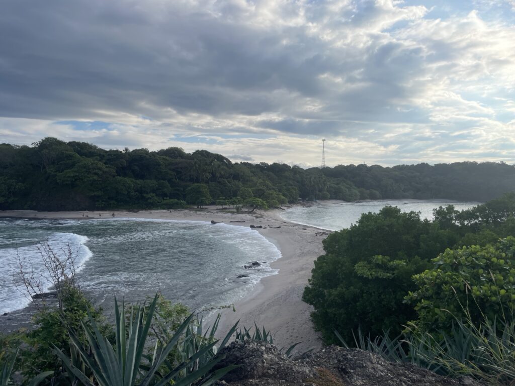
We then continue driving to Cabuya along the coast. Beautiful scenery and beaches but not too much to do as the park is closed on Mondays. Typical.
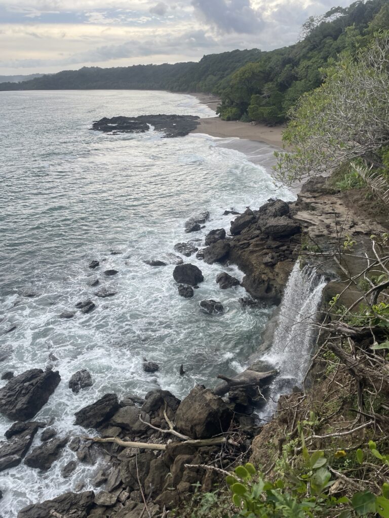
Instead we drive to the Chorro waterfall, one of only seven waterfalls in the world that falls straight into the ocean.
The rest of the afternoon is spent on the surrounding paradise beaches.
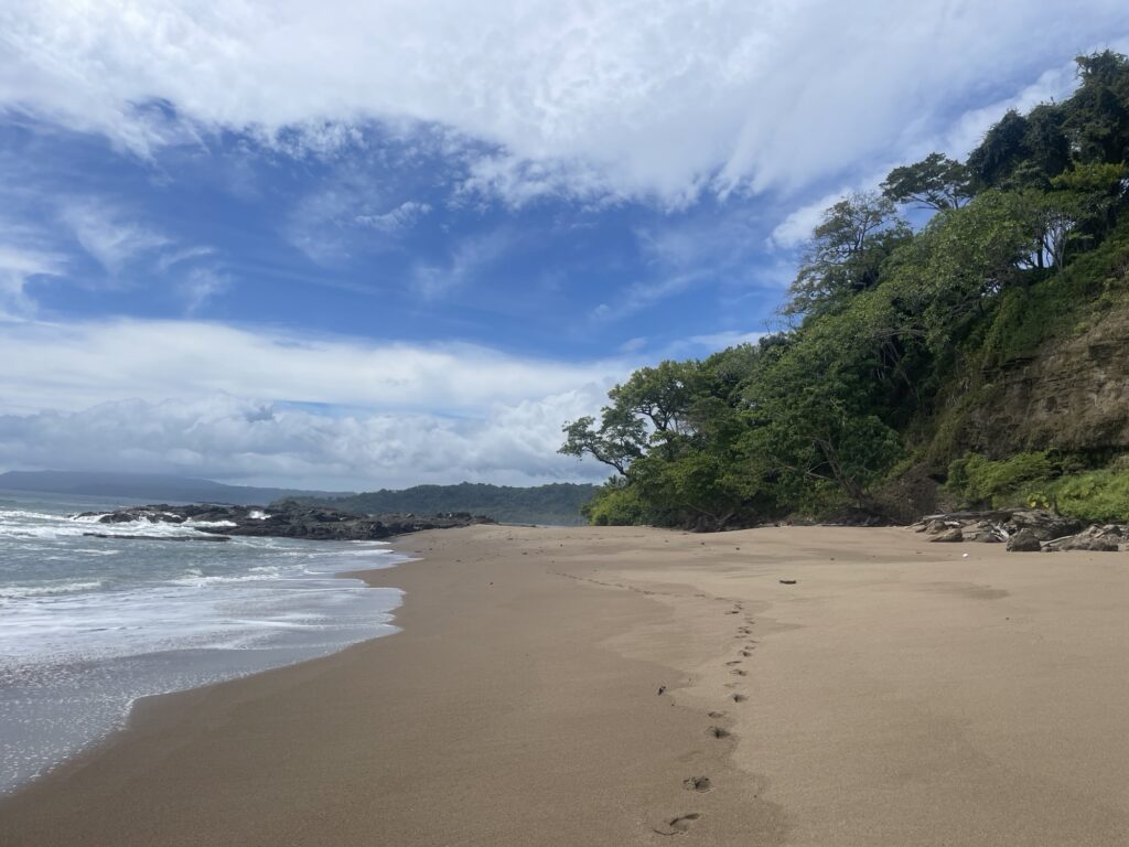
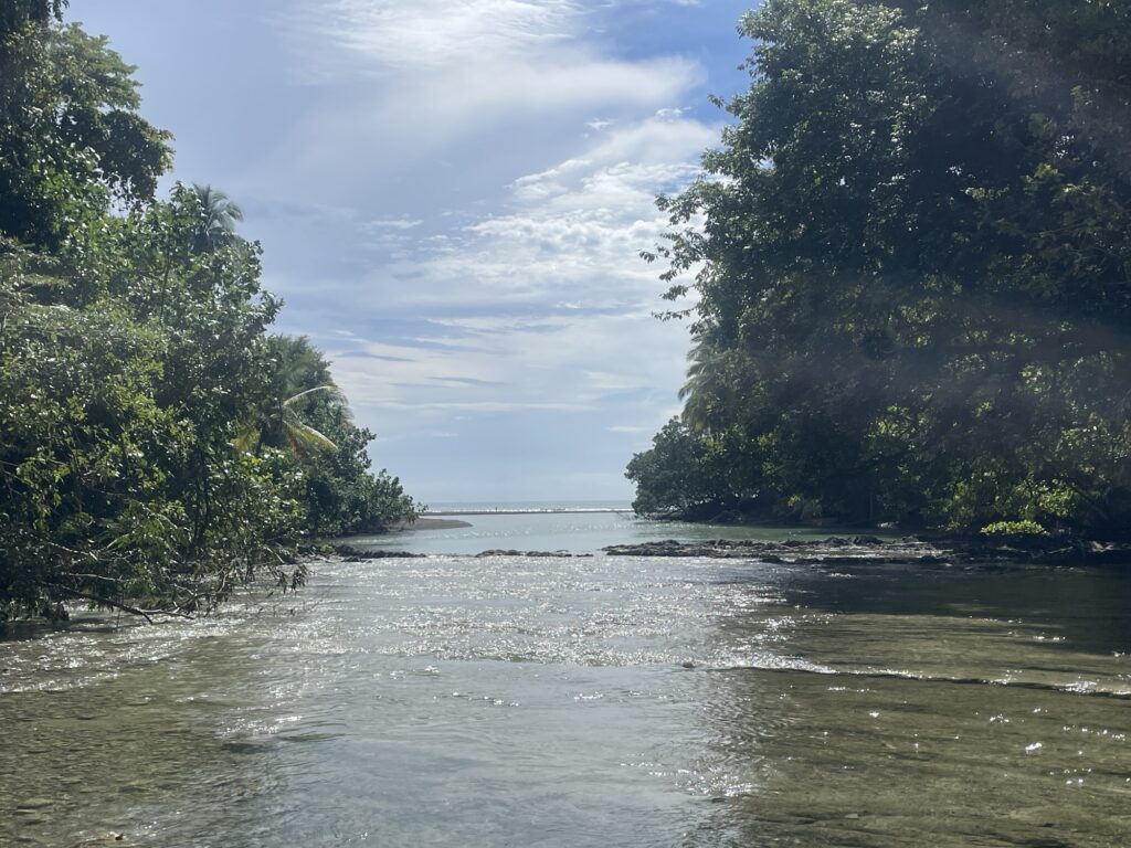
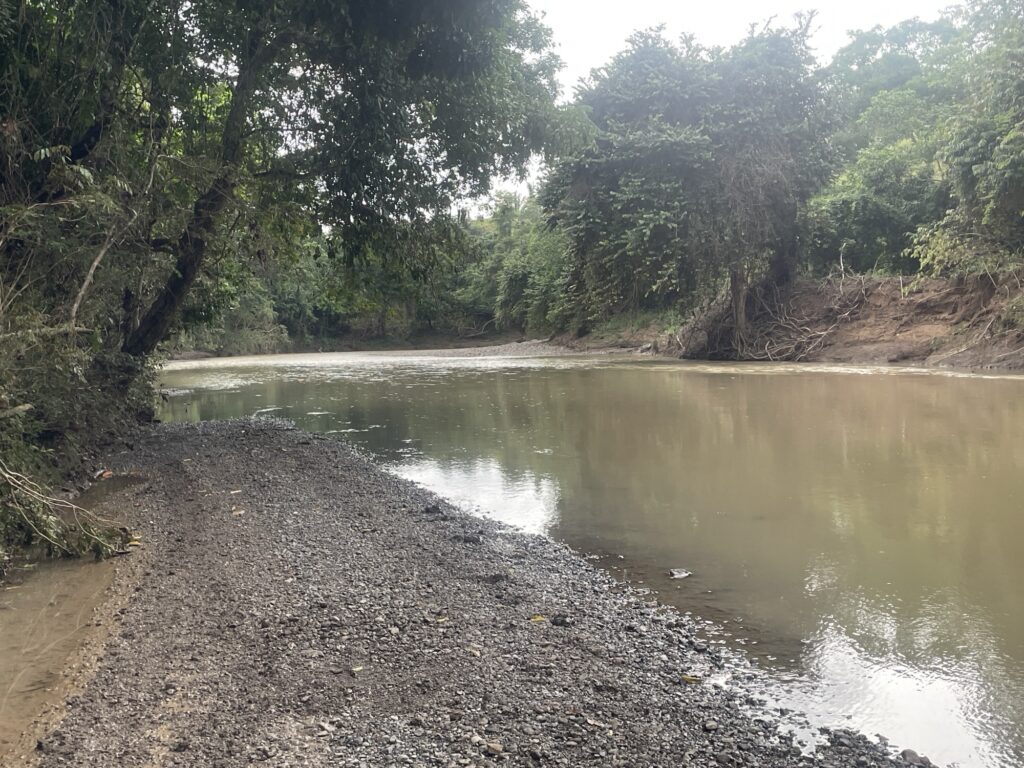
We wanted to continue driving the main coast road to Samara further north. However, after about half an hour driving on really bad dirt roads we come across a river, a river crossed by driving. Our rental car is not up for the challenge, we are forced to take the long route around to Samara, which means driving back to Paquera before continue driving tomorrow.
11 November — Tuesday
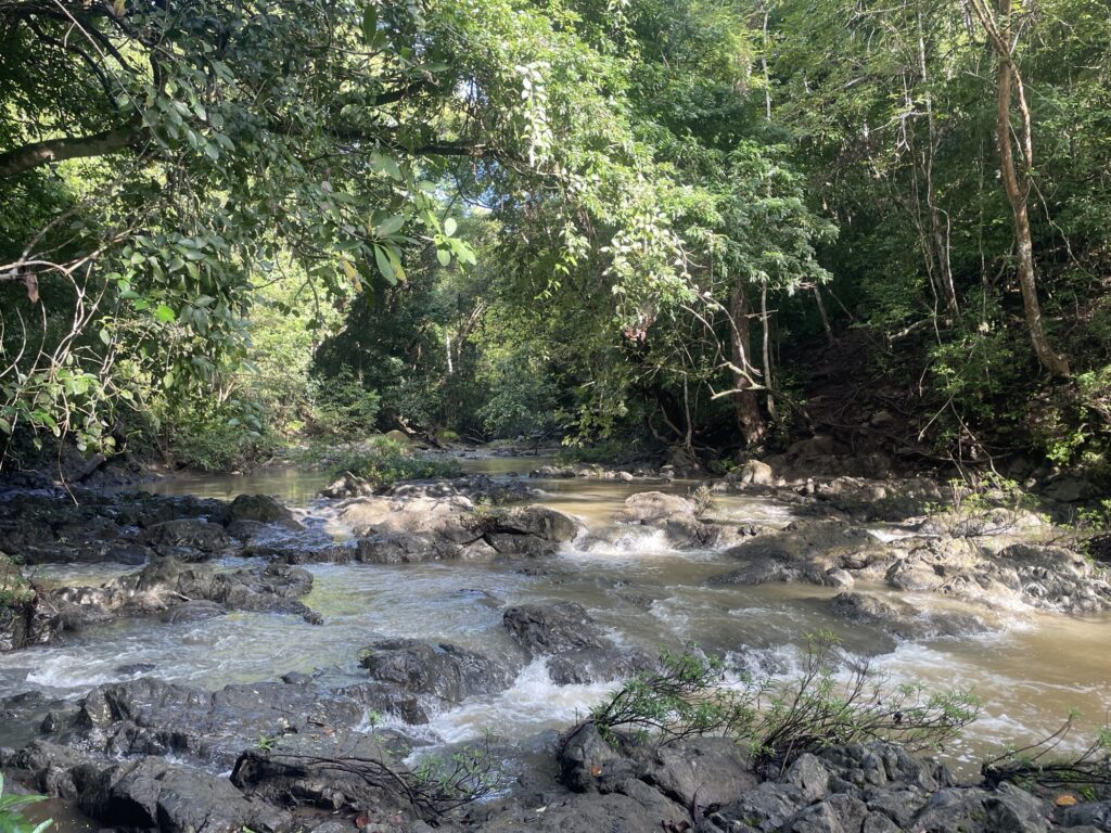
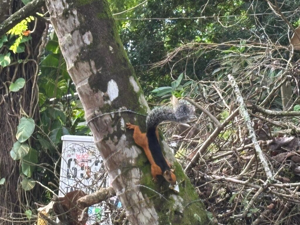
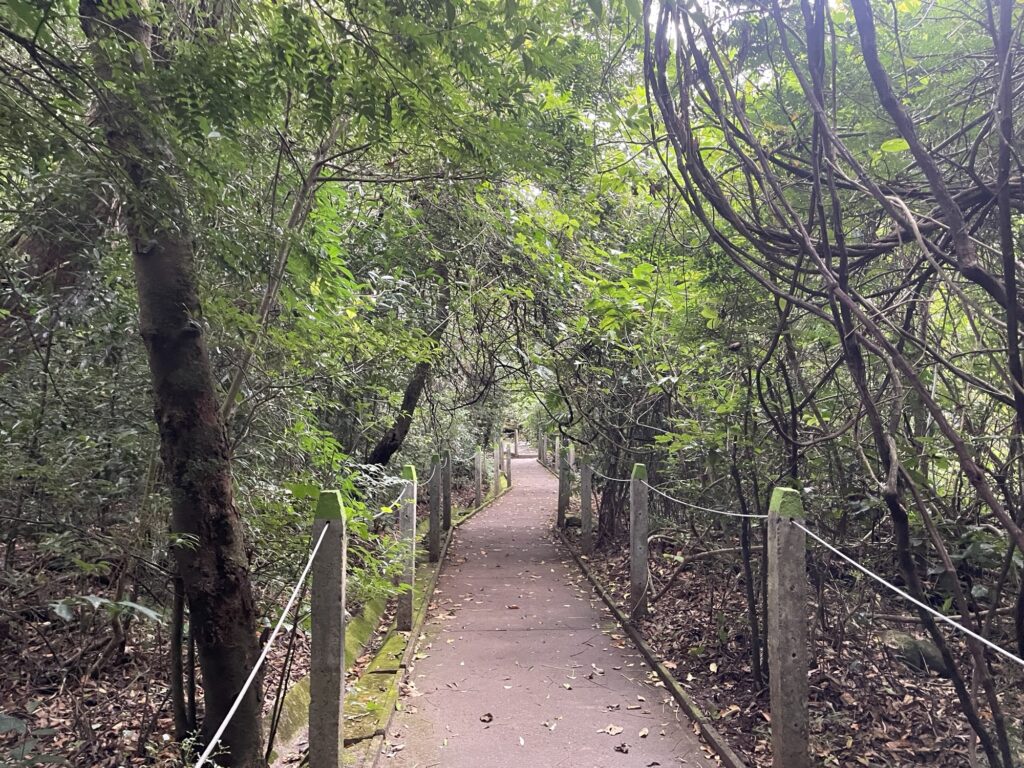
Off to Samara early in the morning with a stop in Reserva Natural Monte Alto. The park has about 6 km of trails that cuts through the rainforest and entrance cost 5 USD/person. It is a nice walk, we constantly hear the Howler monkeys, but unfortunately do not spot any.
After the park visit we continue to the beach city of Samara for an ocean dip. Samara so far has the most beautiful beach I have visited in Costa Rica — no pictures as I left my phone in the car.
Afterwards we continue driving to San Juanillo. When people say that the roads in Costa Rica are bad, they are not exaggerating. It takes us 2h to drive 35 km due to never ending massive potholes, road flooding and mud slides.
12 November — Wednesday
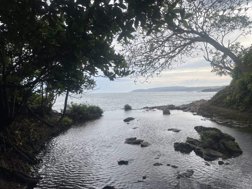
Today we are visiting San Juanillo beach, special for part of the beach stretching out into the ocean.
San Juanillo is a very small and charming paradise city, not overrun by tourists, at least not during the current low season. There are properties for sale everywhere for anyone interested ;).
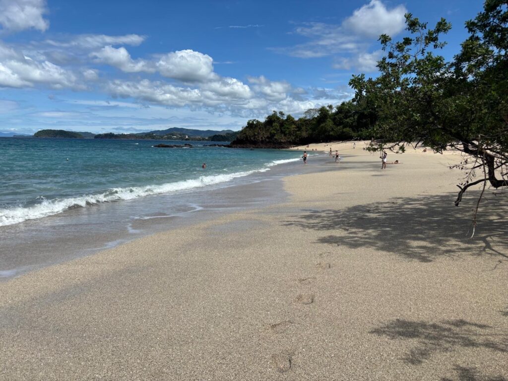
After San Juanillo we drive to Playa Conchal, north of Tamarindo. The surrounding area is not so tranquil, here the town is filled with massive luxurious resorts, and consequently the area is overrun by tourists. To be clear, I’m an adventurer not a tourist :).
The reason we are at Playa Conchal is because it is famous for being a sea shell beach, which my father really wanted to see. I do not know whether that was the case, but it was a very nice beach to swim, run and chill on. The negatives are all the merchants constantly trying to sell you cocktails or food. It truly is a beach for the average tourist.
Afterwards we drive to the city of Liberia, from where we tomorrow will depart to Rincón de la Vieja Volcano National Park.
13 November — Thursday
A bit of a sleep in this morning as the Vieja Volcano National Park opens at 08:00. At precisely 08:00 we arrive at the Las Pailas visitor center, take a look at their handcrafted trail map that was slightly incorrect one might add, and explicitly ask if we are allowed to bath in the hot springs. “Yes you can bath in the hot springs”. Great then that is where we are going first.
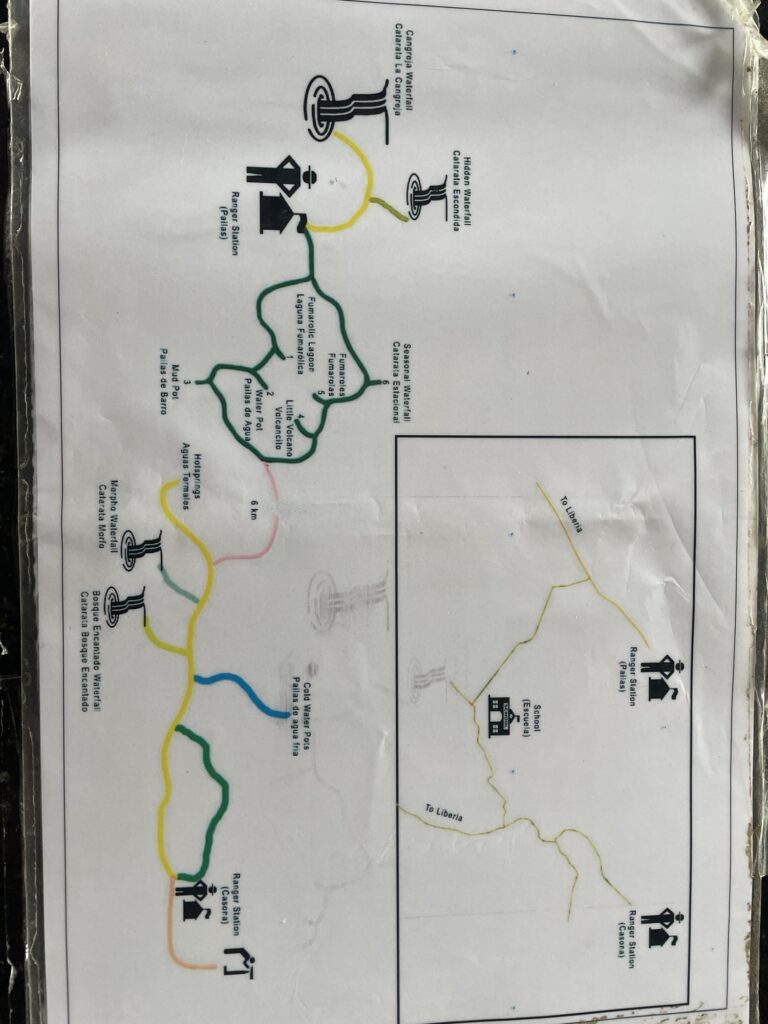
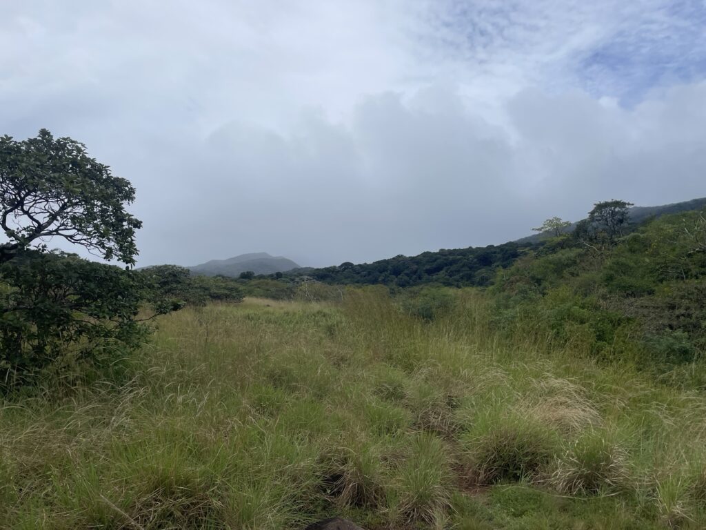
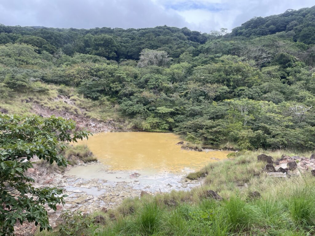
The walk is about 7.5 km, 1.5 km on the well maintained 3 km long well maintained circular main visitor route that features waterfalls, small volcanoes and mud holes, and 6 km on a small forest trail — just as I like it. Considering all the prompted suggestions/warnings to never leave the trail, the trail is surprisingly vague and there are no signs or other markings.
Anyway, we make it to the hot springs and are greeted by a sign that says “Bathing is forbidden”. As always, the information is very conflicting.
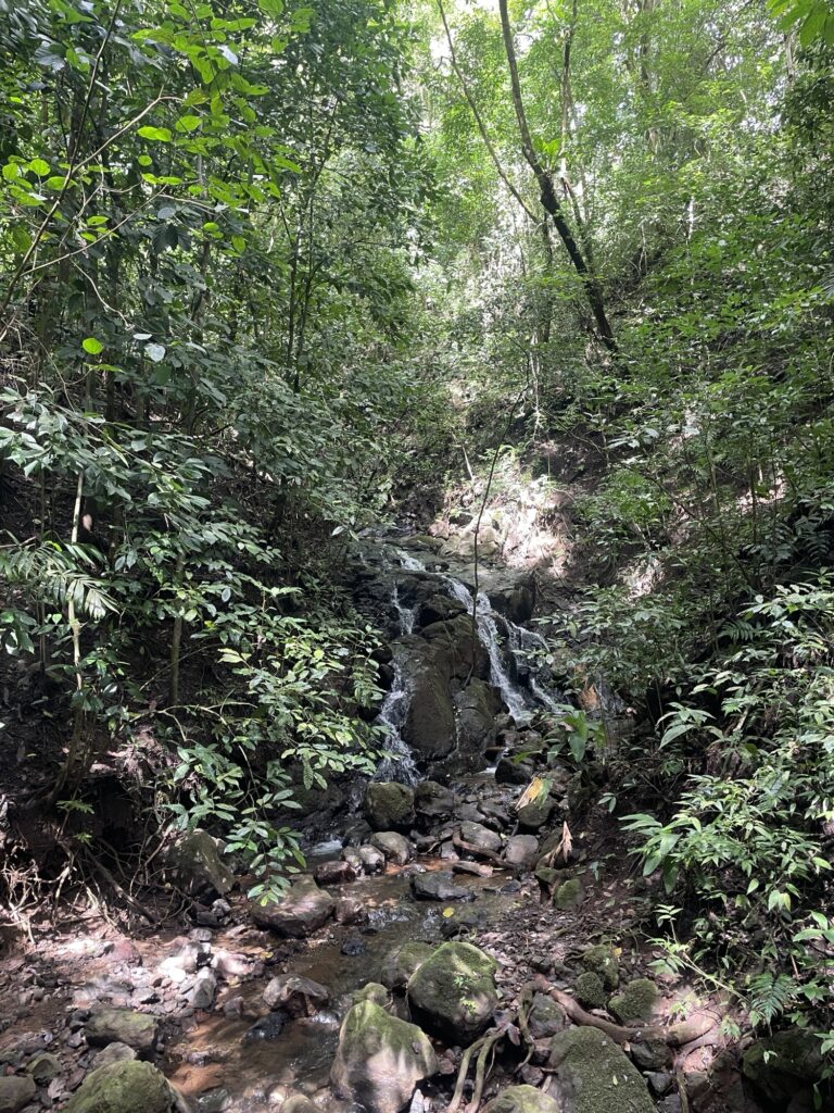
We continue towards the Morpho waterfall. On the way there is another trail and sign post that says “6 km to Las Pailas”. Okey so there are two parallel trails going from Las Pailas to the hot springs — this is not indicated on the map.
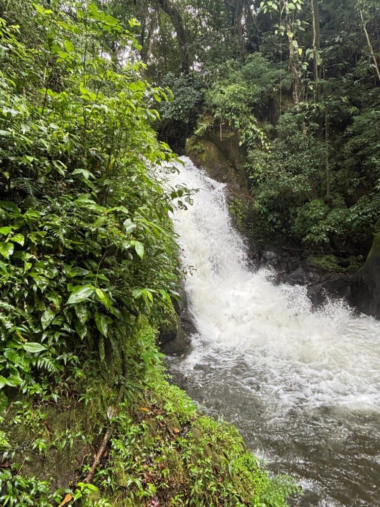
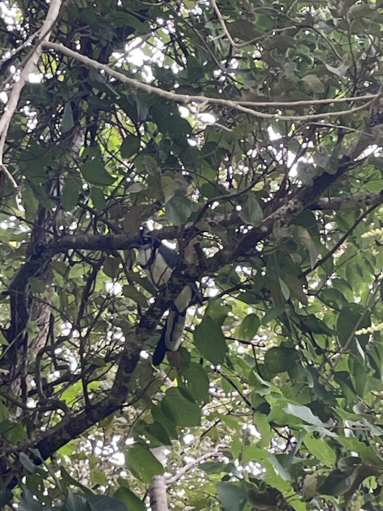
After the visit to Morpho waterfall, we follow the other trail back to Las Pailas. On the way we spot some monkeys, multiple colorful birds and butterflies, and I have a staring contest with what I at the time thought to be 20 fully grown black wild boars, but turns out it is called Collared Peccary. Luckily, I won, they did not call my bluff.
On the way back to the visitor center, we completed the 3 km round loop. From the visitor center there is another 5 km long (one-way) trail that leads to two waterfalls. However, they apparently close the entrance to the trail at 12:00 because the park closes at 16:00 and it is impossible to hike 10 km in 4 hours. And considering we are back at 12:10, after covering about 20 km in 4 hours one might add, we are not allowed entry. I could probably have argued my way in but decided not to, there are other activities we can engage in.
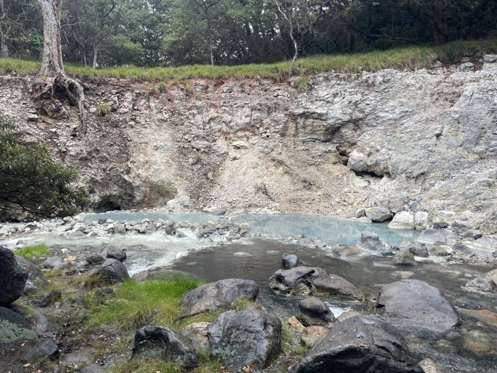
Instead we drive to Rio Negro Hot Springs, where one can pay 34 USD for the opportunity to bath in 35-45 degree Celsius hot springs. Not really my cup of tea, but my father wanted to try it. I must say though that I was intrigued by the promise of mud baths. The “mud baths” meant that you were given a small pile of mud to rub over your body, not exactly what I had envisioned.
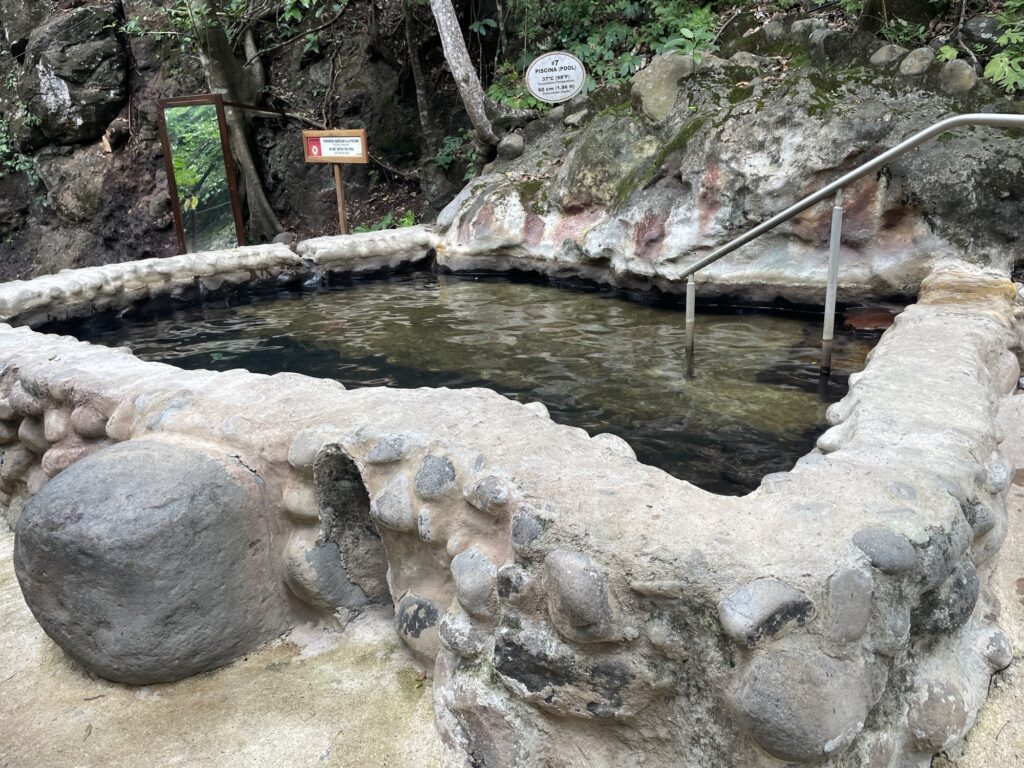
We relax in the various hot-spring for a couple of hours. The 45 degree Celsius pool was a bit too warm, you could feel the burn. After a few minutes in that pool I felt so tired and sluggish. The rest of the pools were comfortable. Lastly, we hike a few hundreds meter to a waterfall to bath in the cold water. Cold and cold, it was probably about 20 degrees, considered warm for a suede but cold for Costa Ricans.
Vieja Volcano Nation Park is well worth a visit. It has about 30 km of total hiking trails, good enough to fill the day. Just make sure to keep track of the time.
With that we leave the Nicoya Peninsula, technically I guess we left it yesterday, but we are leaving the Guanacaste area and driving to Monteverde where we will spend the next day exploring the cloud forests.
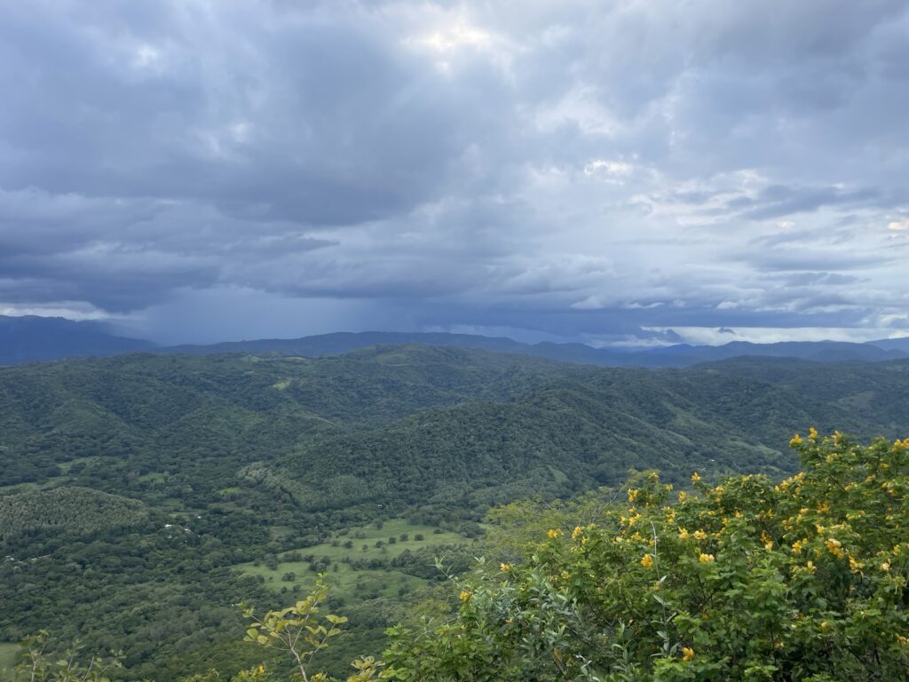
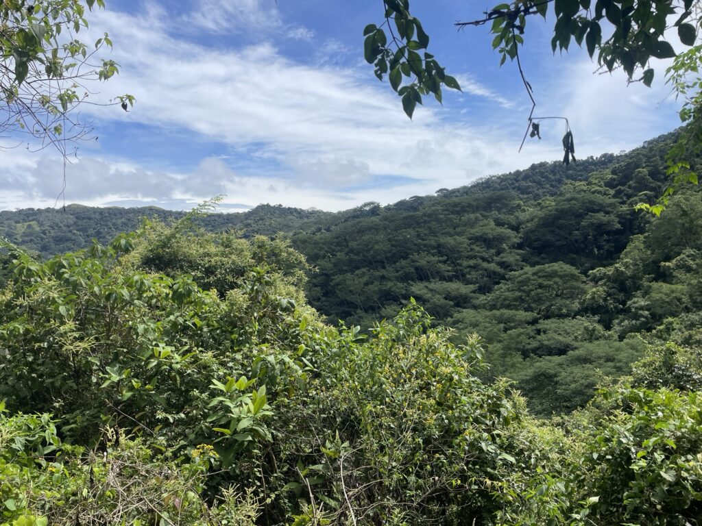
I think the Nicoya Peninsula is stunningly beautiful. A large part of the area is devoted to agriculture, specifically cows. I actually saw no other kind of agriculture, only fields with grazing grass-fed cows. The food in Costa Rica is not cheap, but the meat is.
What makes the Nicoya Peninsula beautiful, despite all the pasture lands, are the way the farmers has chosen to incorporate (or not cut down) many massive trees into the pastures, giving much needed shade to the cows. Additionally, between the pasture the forest remains, and it is not commercial forest. At least I do not think so given the enormous variety in tree and bush species. The landscape is a perfect mixture of thick dense forest and open landscape. It is how I imagine sustainable agriculture to look like, very different from the kind of agriculture you would find in most of Sweden. Of course all the beautiful creeks, rivers and hills adds to the stunningness of the Nicoya Peninsula.
The massive downside with the Nicoya Peninsula, and likely Costa Rica in general, is that it is very closed. Everything is private land and you do not have the right to access it. The locals I spoke to said the owners will mind if you go for a forest walk on their land. It is a shame, because the Nicoya Peninsula has everything I want except the right to roam or hiking trails. The potential for building an incredibly beautiful network of hiking trails is extensive, I hope they do it, but I do not think they will. Their main clientele are after all there to relax on the beaches with a (or many) margaritas.